HOMEOWNERS in the Redlands whose properties fall within mapped wildlife corridors could soon face a new layer of “green tape” environmental regulation.
Redland City Council is investigating bringing back the Environmental Significance Overlay.
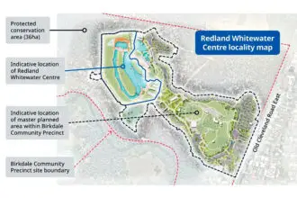
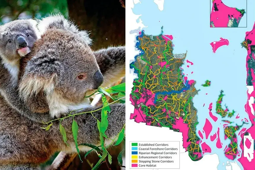
This rule, first suggested in 2021, aims to protect important wildlife corridors and habitats identified in the city’s Wildlife Connections Plan 2018-2028.
The move could once again put hundreds of private landowners under tighter vegetation clearing controls, a prospect that has alarmed some councillors.

Division 7 Councillor Rowanne McKenzie said homeowners were not adequately informed when Council first adopted the Wildlife Connections Plan in 2018 that it could later be used to impose statutory protections on private land.
“I don’t believe Council was transparent about the future implications the plan would have on property owners,” Cr McKenzie said.
“It was not clear that what was a non-statutory plan could later be used to justify a new environmental overlay over people’s properties.”
She said the 2023 consultation on the proposal showed strong opposition among affected property owners.
The amendment was put on hold in 2023 after public consultation drew 284 submissions, with community views evenly split between support and opposition.
However, 72 per cent of property owners directly affected objected.
“The overwhelming majority of landowners affected did not want to be encumbered with yet another overlay on their property,” she said.
“Many already have local and state environmental overlays, and they saw this as too much government green tape.”
Cr McKenzie said residents had demonstrated a commitment to native planting and habitat protection without needing more regulation.
“Council should be educating and partnering with our residents to enhance wildlife corridors, not burdening them with yet another overlay,” she said.
Division 9 Councillor Jason Colley said his community had made its opposition clear, warning the revived proposal could restrict residents’ ability to responsibly manage their own land.
“Before I was elected, members of my local community were very upset about the potential for these corridors being imposed on their properties,” Cr Colley said.
“About three-quarters of my division already has strong environmental overlays — state and local. The suggestion we need an additional layer is a fallacy.”
He said the proposed changes could also complicate hazard management in bushfire-prone areas.
“I genuinely fear residents would be unable to clear vegetation that may present a hazard in the case of a natural disaster,” Cr Colley said.
“I haven’t had one resident tell me they want more protections on their property, but I have heard from many that this isn’t what they want.”
Council officers argued the overlay would bring the City Plan into closer alignment with State Planning Policy 2017 and ShapingSEQ 2023, both of which stress ecological connectivity.
An earlier motion, moved by Cr McKenzie and supported by Cr Colley and three other councillors, sought not to proceed with reintroducing the overlay.
That motion was defeated before councillors voted to support the recommendation, meaning the proposal will proceed to further investigation and analysis before any potential changes to the new City Plan are drafted.