REDLAND City Council is taking a data-driven approach to protect the city’s green canopy and reduce storm damage, with Parks and Conservation Service Manager David Katavic revealing new insights into how emerging technology is transforming tree management.
Speaking during debate on a benchmarking report comparing Redlands’ vegetation practices with North Queensland councils, Mr Katavic said Council’s use of the Forestree tree database was already delivering valuable information.
“So, we’re collecting a tree database at the moment through a program called Forestree App. And what we’re finding is, we’re now knowing what species we’ve got in the city, the sizes, the canopy covers, and all the rest of it,” he said.
“What we’ve already found is that we’ve got some monocultures throughout the city, so if we get some sort of disease coming through, we could get whole species wiped out.
“So, it’s very, very valuable information.”
The benchmarking project, Benchmarking with Northern Queensland Councils on Vegetation Policies and Practices for Extreme Weather Events, stemmed from an April resolution calling for insights into how other councils prepare for and recover from severe weather.
Mr Katavic said that while Redland already had strong vegetation management policies, the new data collection would strengthen its ability to plan proactively and improve coordination with energy providers and developers.
“We’ve collected probably about 10 per cent of the city so far, so there’s a long way to go, but the data collection moving forward will be extremely helpful,” he said.
“It’ll make sure that when we do remove trees for things like the electrical network, we’re putting the right trees back in, and ensuring we’ve got diversity in species selection.”
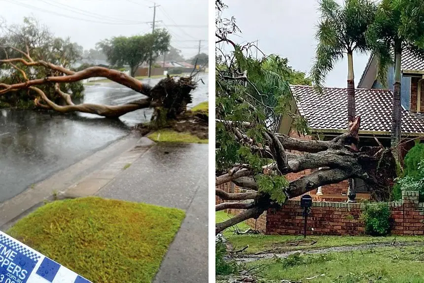
Mr Katavic said Council’s database had already identified about 600 trees greater than 20 metres that may affect the electrical network.
“That’s really valuable information to have, because we can now assess those particular trees, in conjunction with Energex, to see what impact they’re having on the network and the likelihood of them potentially damaging it,” he said.
“We’re not saying that all 600-odd trees are going to cause issues, but because of their height, they could.
“So, it’s not always about removal – sometimes it might just be a pruning program.
“But if removals are necessary, then we work on cost sharing with Energex to remove and replace those trees with more suitable species.”
He said Council was also working closely with the Development Assessment team to guide developers on street tree species and planting locations, with a focus on long-term sustainability.
“We often see street trees squeezed into that little 500mm strip between the kerb and the footpath,” he said.
“We’re recommending that we don’t plant in that space – instead, we plant on the other side, where it’s wider, and use root devices to direct roots deeper so they don’t damage infrastructure.
“It’s not just about removing and replanting – it’s about using different types of pavement materials, like permeable pavers or rubber surfaces, instead of just concrete, to help manage root growth and stormwater.”
Mr Katavic said the Forestree App – already used by Adelaide and the City of Marion in South Australia – was one of the best tree database systems available and allowed for detailed mapping, monitoring and even public access.
“It basically captures all the data about a tree – its height, photos, location, any maintenance history, even a dollar value for the tree,” he said.
“That’s very handy for decision-making, especially when we’re looking at removals.”
“What’s really exciting about Forestree is that it’s outward-facing – the community can actually log on.
“In the City of Marion, you can click on the tree outside your property, and it’ll show you all about it – the species, pruning history, and even the value.
“So, residents can self-serve that information.”
He said Council was even exploring ways for residents to contribute directly to the database.
“One of our ideas is to get residents, when they report a tree issue, to take a photo and GPS-capture the location,” he said.
“That way, it goes straight into our system, and we can do some desktop analysis right away.
“There are a lot of benefits with Forestree.
“It’s one of the best tree database systems out there.”